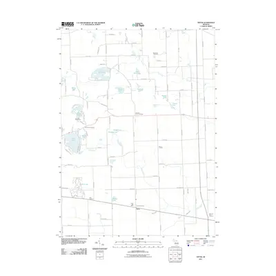
2011 Map of Tipton
USGS Topo · Published 2011About this map
The settlement of Tipton serves as the focal point for this 2011 survey, situated in a landscape defined by an intricate network of glacial lakes and local drainage systems. To the north, Iron Mill Pond and Half Moon Lake connect via Iron Creek, while the southern reaches feature the extensive Evans Lake and its neighbor Jefferey Lake. This geography has long shaped the local economy and recreational culture, evidenced by the presence of the Tecumseh Woods Camp and the Jado Park Campground.
Find a feature on this map
84 named features on this map. Tap any name to fly to it.
Don’t see what you’re looking for? This feature index may not catch every label — zoom into the map to look around manually.
Map Details
Editions of this 2011 Tipton Map
This is the sole edition of this map. No revisions or reprints were ever made.
Other maps of this area

1904 · Ann Arbor
USGS Topo · 1:125,000

1906 · Saline
USGS Topo · 1:62,500

1908 · Ann Arbor
USGS Topo · 1:125,000

1939 · Blissfield
USGS Topo · 1:62,500

1941 · Blissfield
USGS Topo · 1:62,500

1948 · Manchester
USGS Topo · 1:62,500

1949 · Manchester
USGS Topo · 1:62,500

1953 · Fort Wayne
USGS Topo · 1:250,000

1954 · Detroit
USGS Topo · 1:250,000

1956 · Fort Wayne
USGS Topo · 1:250,000