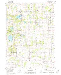
1980 Map of Tipton
USGS Topo · Published 1981About this map
The Irish Hills region of Michigan is defined by its glacial lakes and rolling topography, centered here on the small community of Tipton. The landscape is a network of water bodies such as Evans Lake, Iron Mill Pond, and Half Moon Lake, many of which supported early industrial activity or became recreational centers like Hayes State Park. A notable cultural landmark is Hidden Lake Gardens, operated by Michigan State University, which preserves a large arboretum and botanical collection near Hidden Lake.
Find a feature on this map
43 named features on this map. Tap any name to fly to it.
Don’t see what you’re looking for? This feature index may not catch every label — zoom into the map to look around manually.
Map Details
Editions of this 1980 Tipton Map
This is the sole edition of this map. No revisions or reprints were ever made.
Other maps of this area

1904 · Ann Arbor
USGS Topo · 1:125,000

1906 · Saline
USGS Topo · 1:62,500

1908 · Ann Arbor
USGS Topo · 1:125,000

1939 · Blissfield
USGS Topo · 1:62,500

1941 · Blissfield
USGS Topo · 1:62,500

1948 · Manchester
USGS Topo · 1:62,500

1949 · Manchester
USGS Topo · 1:62,500

1953 · Fort Wayne
USGS Topo · 1:250,000

1954 · Detroit
USGS Topo · 1:250,000

1956 · Fort Wayne
USGS Topo · 1:250,000
Featured Places
- Manchester Township, MI
- Bridgewater Township, MI
- Clinton Township, MI
- Tecumseh Township, MI
- Tipton, Franklin Township