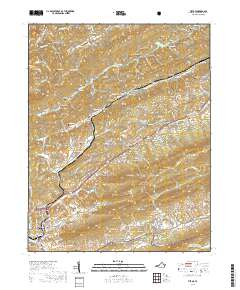
2019 Map of Tiptop
USGS Topo · Published 2019About this map
Tazewell serves as the hub of this Southwest Virginia landscape, situated where the Clinch Valley meets the high ridges of the Appalachians. The terrain is defined by a series of parallel valleys including Abbs Valley and Wrights Valley, carved out by the Bluestone River and the N Fork Clinch River. The settlement pattern reflects the deep-rooted family history of the area, as evidenced by dozens of family burial grounds such as Witten Cem, Sluss Cem, and Peery Cem found along the hillsides. Industrial and recreational footprints are visible at Wittens Mills and the Tazewell County Sportsmen Club Lake, while the northern portion of the map transitions into the protected wilderness of the Jefferson National Forest. This survey also documents the modern rail infrastructure of the Norfolk Southern line as it navigates the complex elevations of the Tennessee Valley Divide and the steep slopes of East River Mtn.
Find a feature on this map
128 named features on this map. Tap any name to fly to it.
Don’t see what you’re looking for? This feature index may not catch every label — zoom into the map to look around manually.
Map Details
Editions of this 2019 Tiptop Map
This is the sole edition of this map. No revisions or reprints were ever made.
Other maps of this area

1887 · Pocahontas
USGS Topo · 1:125,000

1891 · Tazewell
USGS Topo · 1:125,000

1891 · Pocahontas
USGS Topo · 1:125,000

1894 · Pocahontas
USGS Topo · 1:125,000

1895 · Tazewell
USGS Topo · 1:125,000

1895 · Pocahontas
USGS Topo · 1:125,000

1897 · Tazewell
USGS Topo · 1:125,000

1909 · Pocahontas Special
USGS Topo · 1:48,000

1911 · Pocahontas Special
USGS Topo · 1:62,500

1912 · Pounding Mill
USGS Topo · 1:62,500