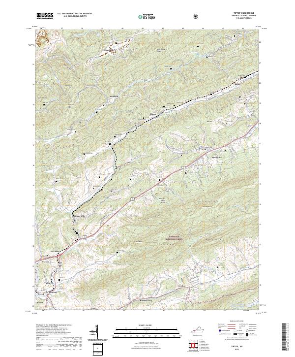
2022 Map of Tiptop
USGS Topo · Published 2022About this map
The Norfolk Southern railroad follows the natural corridor of the N Fork Clinch River and Wrights Valley, connecting a string of highland settlements including Wittens Mills, Five Oaks, and Tiptop. This topography is defined by the sharp parallel ridges of Stony Ridge, East River Mtn, and Buckhorn Mtn, with the Tennessee Valley Divide slicing through the center. The landscape is dotted with family-named burial grounds such as French Cem, Wilburn Cem, and McDowell Cem, documenting the genealogy of the Clinch Valley and Abbs Valley area. Industry and agriculture are centered near Tazewell and Fourway in the southwest, while the eastern portion transitions into the protected slopes of the Jefferson National Forest. Notable landmarks like Dial Rock and Chimney Rock rise above Lynn Hollow and Broad Hollow, framing the narrow valleys where communities like Mud Fork and Springville were established.
Find a feature on this map
119 named features on this map. Tap any name to fly to it.
Don’t see what you’re looking for? This feature index may not catch every label — zoom into the map to look around manually.
Map Details
Editions of this 2022 Tiptop Map
This is the sole edition of this map. No revisions or reprints were ever made.
Other maps of this area

1887 · Pocahontas
USGS Topo · 1:125,000

1891 · Tazewell
USGS Topo · 1:125,000

1891 · Pocahontas
USGS Topo · 1:125,000

1894 · Pocahontas
USGS Topo · 1:125,000

1895 · Tazewell
USGS Topo · 1:125,000

1895 · Pocahontas
USGS Topo · 1:125,000

1897 · Tazewell
USGS Topo · 1:125,000

1909 · Pocahontas Special
USGS Topo · 1:48,000

1911 · Pocahontas Special
USGS Topo · 1:62,500

1912 · Pounding Mill
USGS Topo · 1:62,500