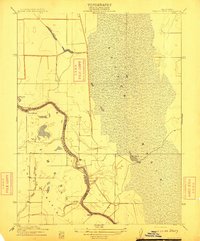
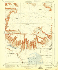
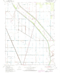
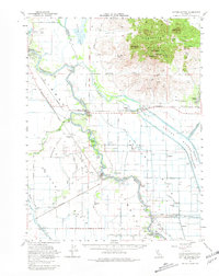
1912 Map of Tisdale Weir
USGS Topo · Published 1912This historical map portrays the area of Tisdale Weir in 1912, primarily covering Sutter County as well as portions of Colusa County. Featuring a scale of 1:31680, this map provides a highly detailed snapshot of the terrain, roads, buildings, counties, and historical landmarks in the Tisdale Weir region at the time. Published in 1912, it is the sole known edition of this map.
Find a feature on this map
13 named features on this map. Tap any name to fly to it.
Don’t see what you’re looking for? This feature index may not catch every label — zoom into the map to look around manually.
Map Details
Editions of this 1912 Tisdale Weir Map
This is the sole edition of this map. No revisions or reprints were ever made.
Historical Maps of Hinsdale Through Time
14 maps found
1910 Marcuse
Sutter County, CA
1910 Vernon
Sutter County, CA
1911 Gilsizer Slough
Sutter County, CA
1912 Marysville Buttes
Sutter County, CA
1912 Tisdale Weir
Sutter County, CA
1915 Kirkville
Sutter County, CA
1952 Gilsizer Slough
Sutter County, CA
1952 Kirkville
Sutter County, CA
1952 Sutter Causeway
Sutter County, CA
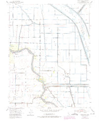
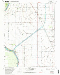
1952 Tisdale Weir
Sutter County, CA
1952 Verona
Sutter County, CA
1954 Sutter Buttes
Sutter County, CA
1954 Sutter Buttes
Sutter County, CA
1967 Verona
Sutter County, CA