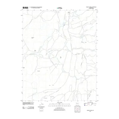
2010 Map of Todilto Park
USGS Topo · Published 2010About this map
Todilto Park occupies a dramatic basin within the Chuska Mountains, where the intersection of geological formations and tribal infrastructure creates a unique western landscape. The topography is defined by sharp vertical features like Cleopatras Needle, Venus Needle, and the curiously named Beelzebub. Water management in this arid environment is evident at the Asaayi Dam and the Bowl Lake Campground, which serve as focal points for the surrounding drainage systems, including Bowl Canyon Creek and Little Water Creek. A network of tribal routes, such as Indian Service Route 311 and Navajo Service Route 131, facilitates travel through the high-elevation terrain. This survey also records various logging paths like Logging 7992 Rd, reflecting the historical and ongoing timber management across Pine Ridge.
Find a feature on this map
32 named features on this map. Tap any name to fly to it.
Don’t see what you’re looking for? This feature index may not catch every label — zoom into the map to look around manually.
Map Details
Editions of this 2010 Todilto Park Map
This is the sole edition of this map. No revisions or reprints were ever made.
Other maps of this area

1886 · Wingate
USGS Topo · 1:250,000

1886 · Fort Defiance
USGS Topo · 1:250,000

1889 · Chaco
USGS Topo · 1:250,000

1892 · Fort Defiance
USGS Topo · 1:250,000

1892 · Wingate
USGS Topo · 1:250,000

1892 · Chaco
USGS Topo · 1:250,000

1892 · Canyon De Chelly
USGS Topo · 1:250,000

1954 · Shiprock
USGS Topo · 1:250,000

1954 · Gallup
USGS Topo · 1:250,000

1955 · Zith-Tusayan Butte 1 SE
USGS Topo · 1:24,000