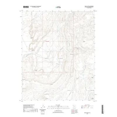
2020 Map of Todilto Park
USGS Topo · Published 2020About this map
Cleopatras Needle and Venus Needle stand as prominent landmarks in this high-elevation landscape of the Chuska Mountains. This 2020 survey of the Fort Defiance Agency area details a complex network of seasonal drainages, including Tohdildonih Wash and Squirrel Spring Wash, which carve through the high plateaus and canyons. The presence of Bowl Lake and Squirrel Springs highlights the scarce but vital water sources in this arid region, while landforms like The Great Eye and Beelzebub suggest a terrain deeply tied to local nomenclature. An extensive system of service routes, such as Navajo Svc Rte 31 and Indian Svc Rte 126, connects the isolated peaks and ridges, reflecting the modern management of these ancestral lands and their use for logging and access.
Find a feature on this map
33 named features on this map. Tap any name to fly to it.
Don’t see what you’re looking for? This feature index may not catch every label — zoom into the map to look around manually.
Map Details
Editions of this 2020 Todilto Park Map
This is the sole edition of this map. No revisions or reprints were ever made.
Other maps of this area

1886 · Wingate
USGS Topo · 1:250,000

1886 · Fort Defiance
USGS Topo · 1:250,000

1889 · Chaco
USGS Topo · 1:250,000

1892 · Fort Defiance
USGS Topo · 1:250,000

1892 · Wingate
USGS Topo · 1:250,000

1892 · Chaco
USGS Topo · 1:250,000

1892 · Canyon De Chelly
USGS Topo · 1:250,000

1954 · Shiprock
USGS Topo · 1:250,000

1954 · Gallup
USGS Topo · 1:250,000

1955 · Zith-Tusayan Butte 1 SE
USGS Topo · 1:24,000