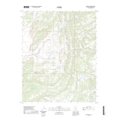
2023 Map of Todilto Park
USGS Topo · Published 2023About this map
The Chuska Mountains dominate this high-desert landscape in McKinley County, where traditional Navajo routes like Navajo Svc Rte 31 and Indian Svc Rte 126 cross a terrain of sharp ridges and deep washes. The map documents scattered settlements such as White Rock, Beelzebub, and Mountain Valley, alongside evocatively named landmarks like The Great Eye and Windy Canyon. The drainage network is complex, featuring the upper reaches of Bowl Canyon Creek and Tohdildonih Wash, while the Dividing Ridge separates distinct watersheds. This area shows a pattern of high-altitude habitation and seasonal infrastructure, with several logging roads like Logging 7892 Rd and Logging 8013 Rd cutting through the timber of Pine Ridge, reflecting the region's managed land use and natural resource history.
Find a feature on this map
29 named features on this map. Tap any name to fly to it.
Don’t see what you’re looking for? This feature index may not catch every label — zoom into the map to look around manually.
Map Details
Editions of this 2023 Todilto Park Map
This is the sole edition of this map. No revisions or reprints were ever made.
Other maps of this area

1886 · Wingate
USGS Topo · 1:250,000

1886 · Fort Defiance
USGS Topo · 1:250,000

1889 · Chaco
USGS Topo · 1:250,000

1892 · Fort Defiance
USGS Topo · 1:250,000

1892 · Wingate
USGS Topo · 1:250,000

1892 · Chaco
USGS Topo · 1:250,000

1892 · Canyon De Chelly
USGS Topo · 1:250,000

1954 · Shiprock
USGS Topo · 1:250,000

1954 · Gallup
USGS Topo · 1:250,000

1955 · Zith-Tusayan Butte 1 SE
USGS Topo · 1:24,000