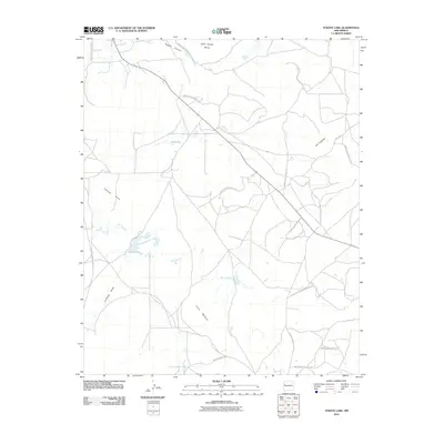
2010 Map of Togeye Lake
USGS Topo · Published 2010About this map
Wild Sheep Mesa and the surrounding high desert terrain dominate this 2010 topographic study of the Eastern Navajo Agency. The seasonal water network is anchored by Togeye Lake and the intermittent flow of the Rio Pescado, which winds through the central portion of the quadrangle. The map reveals a landscape defined by sharp elevation changes, from the depths of Togeye Canyon to the prominent heights of Los Gigantes. An extensive network of Indian Service Routes, including Indian Service Route 132 and Indian Service Route 130, provides the primary infrastructure for the area, connecting remote settlements and ranching lands across Togeye Flats. For those studying the geography of the Zuni River watershed, the drainage patterns of Crockett Draw and the landform of Loma Medios illustrate the complex natural drainage systems of this arid region.
Find a feature on this map
24 named features on this map. Tap any name to fly to it.
Don’t see what you’re looking for? This feature index may not catch every label — zoom into the map to look around manually.
Map Details
Editions of this 2010 Togeye Lake Map
This is the sole edition of this map. No revisions or reprints were ever made.
Other maps of this area

1886 · Wingate
USGS Topo · 1:250,000

1892 · Wingate
USGS Topo · 1:250,000

1954 · Saint Johns
USGS Topo · 1:250,000

1954 · Gallup
USGS Topo · 1:250,000

1957 · Saint Johns
USGS Topo · 1:250,000

1958 · Gallup
USGS Topo · 1:250,000

1958 · Saint Johns
USGS Topo · 1:250,000

1959 · Gallup
USGS Topo · 1:250,000

1962 · Gallup
USGS Topo · 1:250,000

1962 · Saint Johns
USGS Topo · 1:250,000