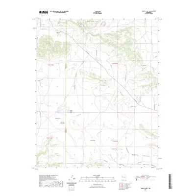
2023 Map of Togeye Lake
USGS Topo · Published 2023About this map
Wild Sheep Mesa and the prominent Los Gigantes formation define this high-desert landscape on the border of McKinley and Cibola Counties. The settlement of Ramah sits at the northern edge of the sheet, while the small community of Mountain View is located in the southeast corner. This 2023 survey illustrates a complex network of canyons and arroyos, including Togeye Canyon, Crockett Draw, and Carrizozo Draw, which funnel seasonal drainage toward the Rio Pescado.
Find a feature on this map
46 named features on this map. Tap any name to fly to it.
Don’t see what you’re looking for? This feature index may not catch every label — zoom into the map to look around manually.
Map Details
Editions of this 2023 Togeye Lake Map
This is the sole edition of this map. No revisions or reprints were ever made.
Other maps of this area

1886 · Wingate
USGS Topo · 1:250,000

1892 · Wingate
USGS Topo · 1:250,000

1954 · Saint Johns
USGS Topo · 1:250,000

1954 · Gallup
USGS Topo · 1:250,000

1957 · Saint Johns
USGS Topo · 1:250,000

1958 · Gallup
USGS Topo · 1:250,000

1958 · Saint Johns
USGS Topo · 1:250,000

1959 · Gallup
USGS Topo · 1:250,000

1962 · Gallup
USGS Topo · 1:250,000

1962 · Saint Johns
USGS Topo · 1:250,000