
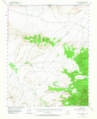
1953 Map of Toh-Atin Mesa
USGS Topo · Published 1956About this map
Immanuel Mission and the Sweetwater Trading Post anchor this mid-century survey of the high desert along the Utah Arizona border. Located within the Navajo Indian Reservation, the landscape is defined by massive geological formations and deep drainages. The Toh-Atin Mesa and Dry Mesa rise above complex canyon systems including Toh-Chin-Lini Canyon and Seklagaidesa Canyon.
Find a feature on this map
25 named features on this map. Tap any name to fly to it.
Don’t see what you’re looking for? This feature index may not catch every label — zoom into the map to look around manually.
Map Details
Editions of this 1953 Toh-Atin Mesa Map
2 editions found
Other maps of this area

1886 · Abajo
USGS Topo · 1:250,000

1892 · Abajo
USGS Topo · 1:250,000

1892 · Canyon De Chelly
USGS Topo · 1:250,000

1893 · Abajo
USGS Topo · 1:250,000

1953 · Los Gigantes NE
USGS Topo · 1:24,000

1953 · Los Gigantes NW
USGS Topo · 1:24,000

1953 · Dinne Mesa NW
USGS Topo · 1:24,000

1953 · Pastora Peak SW
USGS Topo · 1:24,000

1953 · Pastora Peak NW
USGS Topo · 1:24,000

1953 · Dinne Mesa NE
USGS Topo · 1:24,000
Featured Places
- Shiprock Agency
- Totacon, Shiprock Agency
- Emmanuel Mission, Shiprock Agency
- Red Mesa, Shiprock Agency
- Apache County, AZ