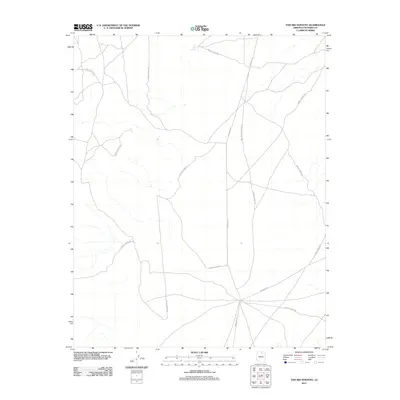
2011 Map of Toh Bih Nosteny
USGS Topo · Published 2011About this map
Toh Bih Nosteny names a solitary water feature on this high-desert plateau in Coconino County, where the landscape is defined by the intersection of administrative road networks. The terrain is crisscrossed by several iterations of Forest Service Rd, which serve the expansive back country of northern Arizona. These primitive routes connect with more formal arteries like Indian Rte 20 and Indian Rte 21, suggesting a region where transportation is tied to land management and tribal access. The lack of named settlements reflects the isolation of the area, where water sources like Toh Bih Nosteny were critical landmarks for travelers navigating between the San Francisco Peaks and the Painted Desert.
Find a feature on this map
4 named features on this map. Tap any name to fly to it.
Don’t see what you’re looking for? This feature index may not catch every label — zoom into the map to look around manually.
Map Details
Editions of this 2011 Toh Bih Nosteny Map
This is the sole edition of this map. No revisions or reprints were ever made.
Other maps of this area
1886 · Echo Cliffs
USGS Topo · 1:250,000
1891 · Echo Cliffs
USGS Topo · 1:250,000
1954 · Shinumo Altar NE
USGS Topo · 1:24,000
1954 · Shinumo Altar SE
USGS Topo · 1:24,000
1954 · Tanner Wash
USGS Topo · 1:62,500
1954 · Shinumo Altar
USGS Topo · 1:62,500

1956 · Marble Canyon
USGS Topo · 1:250,000
1957 · The Gap SW
USGS Topo · 1:24,000

1959 · Marble Canyon
USGS Topo · 1:250,000

1961 · Marble Canyon
USGS Topo · 1:250,000