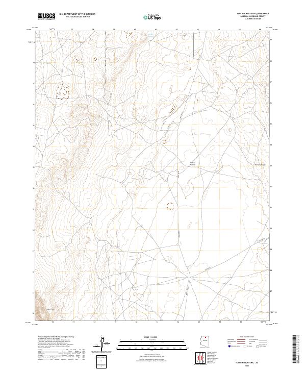
2021 Map of Toh Bih Nosteny
USGS Topo · Published 2021About this map
Toh Bih Nosteny and the surrounding high desert of the Navajo Nation define this northern Arizona landscape. The terrain is dominated by the dramatic rise of the Echo Cliffs in the southwest and the expansive Kaibito Plateau to the east, illustrating a classic Colorado Plateau topography of mesas and deep drainage patterns. Settlement is sparse, represented primarily by a network of local roads including Indian Rte 20 and Kaibeto Rd that follow the natural contours of the land. The presence of Mormon Ridges in the northeast suggests early exploration or transit routes through this arid region. This 2021 survey by the U.S. Geological Survey provides a modern topographic record of the remote back-country, where ancient geological formations remain the primary landmarks for navigation and local history.
Find a feature on this map
14 named features on this map. Tap any name to fly to it.
Don’t see what you’re looking for? This feature index may not catch every label — zoom into the map to look around manually.
Map Details
Editions of this 2021 Toh Bih Nosteny Map
This is the sole edition of this map. No revisions or reprints were ever made.
Other maps of this area

1886 · Echo Cliffs
USGS Topo · 1:250,000

1891 · Echo Cliffs
USGS Topo · 1:250,000

1954 · Shinumo Altar NE
USGS Topo · 1:24,000

1954 · Shinumo Altar SE
USGS Topo · 1:24,000

1954 · Tanner Wash
USGS Topo · 1:62,500

1954 · Shinumo Altar
USGS Topo · 1:62,500

1956 · Marble Canyon
USGS Topo · 1:250,000
1957 · The Gap SW
USGS Topo · 1:24,000

1959 · Marble Canyon
USGS Topo · 1:250,000

1961 · Marble Canyon
USGS Topo · 1:250,000