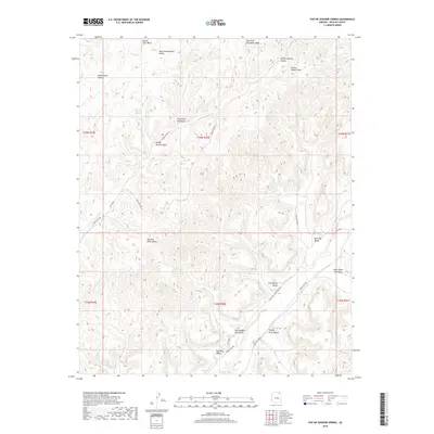
2018 Map of Toh Ne Zhonnie Spring
USGS Topo · Published 2018About this map
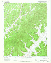
Toh Ne Zhonnie Spring sits at the heart of this high-desert landscape within the Chinle Agency, where a network of ephemeral washes and deeply carved valleys define the geography. The drainage pattern is led by Oraibi Wash and Toh Ne Zhonnie Wash, carving through distinct landforms like Two Red Peaks Valley and Many Greasewood Valley. This area is characterized by its isolation and the naming of specific natural features that have likely served as vital landmarks for generations. Navigation through this remote terrain is facilitated by several tribal routes, including Indian Rte 8033 and Indian Rte 8066, which trace the contours of the valleys. Other notable water sources like Cliff Spring and various named washes, such as Yellow Jacket Wash and Forest Lake Wash, highlight the critical importance of water locations in this arid Navajo County environment.
Find a feature on this map
31 named features on this map. Tap any name to fly to it.
Don’t see what you’re looking for? This feature index may not catch every label — zoom into the map to look around manually.
Map Details
Editions of this 2018 Toh Ne Zhonnie Spring Map
This is the sole edition of this map. No revisions or reprints were ever made.
Other maps of this area

1883 · Marsh Pass
USGS Topo · 1:250,000

1892 · Marsh Pass
USGS Topo · 1:250,000

1956 · Marble Canyon
USGS Topo · 1:250,000

1959 · Marble Canyon
USGS Topo · 1:250,000

1961 · Marble Canyon
USGS Topo · 1:250,000
1967 · Pinon NW
USGS Topo · 1:24,000
1967 · Coat Spring
USGS Topo · 1:24,000
1967 · Burnt Corn Spring
USGS Topo · 1:24,000
1968 · Toh Ne Zhonnie Spring
USGS Topo · 1:24,000
1968 · Hole In Rock Valley
USGS Topo · 1:24,000