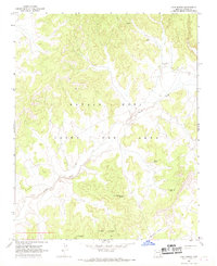
1967 Map of Coat Spring
USGS Topo · Published 1969About this map
The Navajo - Hopi Joint Use Area dominates this late-1960s landscape, reflecting a complex period of shared jurisdictional history in the high desert. The terrain is defined by the winding course of Oraibi Wash as it cuts through the plateau, creating a network of drainage patterns that converge near White Valley. Water sources are the critical landmarks for this region, with small settlements and named locations clustered around vital points like Coat Spring, Saa Betoh, and Tse No Dozz. The presence of Water on the Rock Spring, Little Spring, and the Kai Si Caude Well highlights the essential nature of these scattered water features in an otherwise arid environment. This 1967 field-checked survey preserves the exact placement of these traditional Navajo and Hopi landmarks before later administrative changes shifted the management of these lands.
Find a feature on this map
9 named features on this map. Tap any name to fly to it.
Don’t see what you’re looking for? This feature index may not catch every label — zoom into the map to look around manually.
Map Details
Editions of this 1967 Coat Spring Map
This is the sole edition of this map. No revisions or reprints were ever made.
Other maps of this area

1883 · Marsh Pass
USGS Topo · 1:250,000

1892 · Marsh Pass
USGS Topo · 1:250,000

1956 · Marble Canyon
USGS Topo · 1:250,000

1959 · Marble Canyon
USGS Topo · 1:250,000

1961 · Marble Canyon
USGS Topo · 1:250,000
1967 · Hard Rocks
USGS Topo · 1:24,000
1967 · Big Mountain Dam
USGS Topo · 1:24,000
1967 · Pinon NW
USGS Topo · 1:24,000
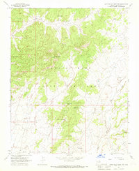
1967 · Little Black Spot Mtn
USGS Topo · 1:24,000
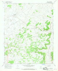
1967 · Pinon
USGS Topo · 1:24,000