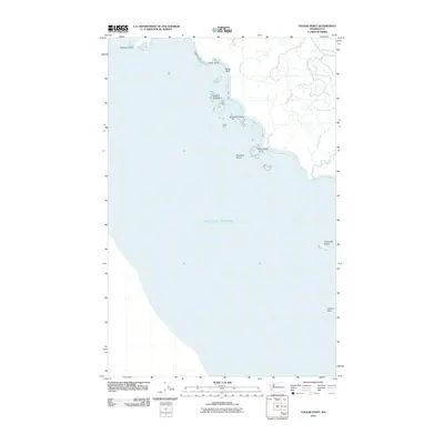
2011 Map of Toleak Point
USGS Topo · Published 2011About this map
Toleak Point and the adjacent coastline of Jefferson County define this transition between the evergreen forests of the Olympic Peninsula and the Pacific Ocean. This 2011 survey records the intricate shoreline where drainage systems like Goodman Creek and Jackson Creek meet the sea amidst a complex of rocky offshore features. The naming of landmarks such as Giants Graveyard, Scotts Bluff, and Strawberry Point reflects a maritime geography shaped by both navigation and local lore. Further south, the map illustrates the isolation of Alexander Island and the jagged shelf of Perkins Reef. The lack of significant road infrastructure underscores the wilderness character of this reach, showing only the natural intersection of water and stone at points like Teahwhit Head and Taylor Point.
Find a feature on this map
15 named features on this map. Tap any name to fly to it.
Don’t see what you’re looking for? This feature index may not catch every label — zoom into the map to look around manually.
Map Details
Editions of this 2011 Toleak Point Map
This is the sole edition of this map. No revisions or reprints were ever made.
Other maps of this area

1939 · Forks
USGS Topo · 1:62,500

1943 · Copalis Beach
USGS Topo · 1:250,000

1951 · Copalis Beach
USGS Topo · 1:250,000

1956 · Destruction Island
USGS Topo · 1:62,500

1956 · La Push
USGS Topo · 1:62,500

1957 · Forks
USGS Topo · 1:62,500

1957 · Copalis Beach
USGS Topo · 1:250,000

1963 · Copalis Beach
USGS Topo · 1:250,000
1981 · Forks
USGS Topo · 1:24,000
1982 · La Push
USGS Topo · 1:24,000