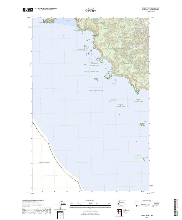
2023 Map of Toleak Point
USGS Topo · Published 2023About this map
Olympic National Park defines this coastal landscape where the Olympic Mountains meet the Pacific Ocean. This survey highlights the intricate shoreline of Jefferson County, where numerous prominent landforms such as Teahwhit Head, Toleak Point, and Taylor Point mark the interface between land and sea. The interior is characterized by a series of drainages, including Goodman Creek, Jackson Creek, and Scott Creek, which flow through heavily forested terrain toward the coast. Coastal features like Strawberry Bay and offshore landmarks such as Alexander Island and Rounded Island are preserved within the Washington Islands Wilderness and Quillayute Needles National Wildlife Refuge. This map details a remote, protected wilderness environment where natural topography remains the primary feature.
Find a feature on this map
21 named features on this map. Tap any name to fly to it.
Don’t see what you’re looking for? This feature index may not catch every label — zoom into the map to look around manually.
Map Details
Editions of this 2023 Toleak Point Map
This is the sole edition of this map. No revisions or reprints were ever made.
Other maps of this area

1939 · Forks
USGS Topo · 1:62,500

1943 · Copalis Beach
USGS Topo · 1:250,000

1951 · Copalis Beach
USGS Topo · 1:250,000

1956 · Destruction Island
USGS Topo · 1:62,500

1956 · La Push
USGS Topo · 1:62,500

1957 · Forks
USGS Topo · 1:62,500

1957 · Copalis Beach
USGS Topo · 1:250,000

1963 · Copalis Beach
USGS Topo · 1:250,000
1981 · Forks
USGS Topo · 1:24,000
1982 · La Push
USGS Topo · 1:24,000