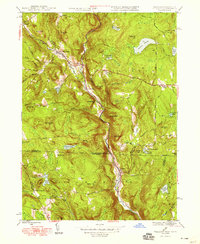
1948 Map of Tolland
USGS Topo · Published 1948About this map
The West Branch Farmington River carves a deep valley through the Berkshire and Litchfield hills, serving as the central artery for small communities like New Boston and Roosterville in the late 1940s. This survey captures a moment when the rugged terrain between Sandisfield and Tolland was defined by scattered hill-country settlements and numerous upland water bodies, including Noyes Pond, Simons Pond, and Mirror Lake.
Find a feature on this map
77 named features on this map. Tap any name to fly to it.
Don’t see what you’re looking for? This feature index may not catch every label — zoom into the map to look around manually.
Map Details
Editions of this 1948 Tolland Map
3 editions found
Other maps of this area

1887 · Granville
USGS Topo · 1:62,500

1888 · Sandisfield
USGS Topo · 1:62,500

1889 · Granville
USGS Topo · 1:62,500

1892 · Winsted
USGS Topo · 1:62,500

1892 · Granby
USGS Topo · 1:62,500

1893 · Granville
USGS Topo · 1:62,500

1893 · Sandisfield
USGS Topo · 1:62,500

1895 · Granville
USGS Topo · 1:62,500

1896 · Holyoke
USGS Topo · 1:125,000

1897 · Sandisfield
USGS Topo · 1:62,500