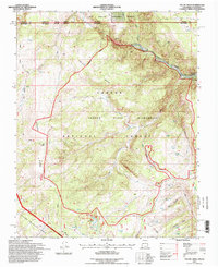
1995 Map of Toltec Mesa
USGS Topo · Published 1998About this map
Rio de los Pinos carves through the northern reaches of this high-altitude landscape, defining the dramatic Toltec Gorge. This corridor is famously traversed by the Cumbres & Toltec Scenic RR, which follows the winding canyon floor and skirts the edges of Toltec Mesa. The terrain is characterized by a high-elevation wilderness system, primarily dominated by the Cruces Basin Wilderness and the surrounding Carson National Forest.
Find a feature on this map
41 named features on this map. Tap any name to fly to it.
Don’t see what you’re looking for? This feature index may not catch every label — zoom into the map to look around manually.
Map Details
Editions of this 1995 Toltec Mesa Map
This is the sole edition of this map. No revisions or reprints were ever made.
Other maps of this area

1918 · Tusas
USGS Topo · 1:125,000

1922 · Conejos
USGS Topo · 1:125,000

1945 · Durango
USGS Topo · 1:250,000

1953 · Durango
USGS Topo · 1:250,000

1954 · Durango
USGS Topo · 1:250,000

1954 · Aztec
USGS Topo · 1:250,000

1955 · Brazos Peak
USGS Topo · 1:62,500

1958 · Aztec
USGS Topo · 1:250,000

1961 · Durango
USGS Topo · 1:250,000

1962 · Aztec
USGS Topo · 1:250,000