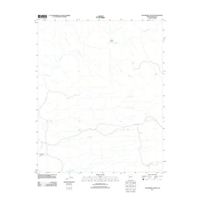
2011 Map of Tom Brown Canyon
USGS Topo · Published 2011About this map
Trout Creek winds through this arid section of Mohave County, where the landscape is defined by its seasonal water sources and deep incisions. This area is characterized by a series of critical watering points for ranching or wildlife, including the curiously named Buckley Tunnel Spring and Blue Mary Spring. The map documents a rugged drainage network where Pearson Falls Wash and Tom Brown Canyon descend toward the larger creek bed. Settlement is sparse, with infrastructure limited to the unpaved Trout Creek Rd, which provides access to remote locations like Indian Grade Spring and Nelson Spring. The naming conventions of the springs, such as Gerome Spring and Cotton Spring, suggest a history of local navigation and land use centered entirely on these vital desert water sources.
Find a feature on this map
15 named features on this map. Tap any name to fly to it.
Don’t see what you’re looking for? This feature index may not catch every label — zoom into the map to look around manually.
Map Details
Editions of this 2011 Tom Brown Canyon Map
This is the sole edition of this map. No revisions or reprints were ever made.
Other maps of this area

1886 · Diamond Creek
USGS Topo · 1:250,000

1892 · Diamond Creek
USGS Topo · 1:250,000

1923 · Signal
USGS Topo · 1:250,000

1942 · Signal
USGS Topo · 1:250,000

1948 · Williams
USGS Topo · 1:250,000

1950 · Prescott
USGS Topo · 1:250,000

1954 · Prescott
USGS Topo · 1:250,000

1954 · Williams
USGS Topo · 1:250,000

1956 · Williams
USGS Topo · 1:250,000

1958 · Prescott
USGS Topo · 1:250,000