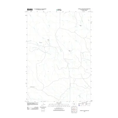
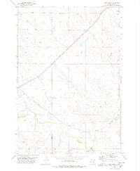
2012 Map of Tomato Can Buttes
USGS Topo · Published 2012About this map
Tomato Can Buttes anchor the southwestern corner of this landscape in Butte County, where the high plains of South Dakota are carved by an intricate network of drainage draws and seasonal waterways. The S Fork Moreau River meanders across the central terrain, joined by tributaries such as Horse Cr and Hay Cr. This region's ranching and aviation history is evidenced by the presence of the Kirk Landing Strip near the confluence of Palmer Draw and Horse Creek. Human passage through this open country is defined by isolated routes like Old Twilight Rd, which cuts north-south through the eastern half of the map. The distribution of features like Gladson Draw and Zurcher Draw reveals a geography dictated by water erosion and the sparse infrastructure typical of the western Dakota plains.
Find a feature on this map
10 named features on this map. Tap any name to fly to it.
Don’t see what you’re looking for? This feature index may not catch every label — zoom into the map to look around manually.
Map Details
Editions of this 2012 Tomato Can Buttes Map
This is the sole edition of this map. No revisions or reprints were ever made.
Other maps of this area

1913 · Newell
USGS Topo · 1:125,000

1935 · Hoover
USGS Topo · 1:125,000

1953 · Rapid City
USGS Topo · 1:250,000

1954 · Lemmon
USGS Topo · 1:250,000

1957 · Lemmon
USGS Topo · 1:250,000

1957 · Rapid City
USGS Topo · 1:250,000
1973 · Deers Ears Butte North
USGS Topo · 1:24,000
1977 · Deers Ears Butte South
USGS Topo · 1:24,000
1978 · Owl Butte NE
USGS Topo · 1:24,000
1978 · Camp Creek
USGS Topo · 1:24,000