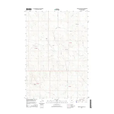
2015 Map of Tomato Can Buttes
USGS Topo · Published 2015About this map
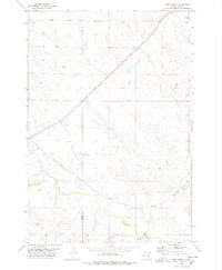
Tomato Can Buttes rise above the drainage basins of northwestern South Dakota, defining a landscape shaped by intermittent watercourses and wide rangelands. The central waterway, the S Fork Moreau River, meanders eastward through the center of the sheet, joined by several significant tributaries including Horse Cr and Trail Cr. This 2015 U.S. Geological Survey representation of Butte County highlights the rural infrastructure of the region, where a sparse network of roads like Twilight Rd and S Moreau Ln provide the only access across the vast sections of the Public Land Survey System. The terrain is notably dissected by a series of named topographic depressions, including Palmer Draw, Gladson Draw, and Zurcher Draw, which illustrate the complex erosion patterns characteristic of the high plains north of Belle Fourche.
Find a feature on this map
15 named features on this map. Tap any name to fly to it.
Don’t see what you’re looking for? This feature index may not catch every label — zoom into the map to look around manually.
Map Details
Editions of this 2015 Tomato Can Buttes Map
This is the sole edition of this map. No revisions or reprints were ever made.
Other maps of this area

1913 · Newell
USGS Topo · 1:125,000

1935 · Hoover
USGS Topo · 1:125,000

1953 · Rapid City
USGS Topo · 1:250,000

1954 · Lemmon
USGS Topo · 1:250,000

1957 · Lemmon
USGS Topo · 1:250,000

1957 · Rapid City
USGS Topo · 1:250,000
1973 · Deers Ears Butte North
USGS Topo · 1:24,000
1977 · Deers Ears Butte South
USGS Topo · 1:24,000
1978 · Owl Butte NE
USGS Topo · 1:24,000
1978 · Camp Creek
USGS Topo · 1:24,000