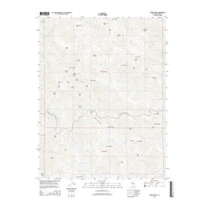
2015 Map of Tombs Creek
USGS Topo · Published 2015About this map
Stewarts Point Skaggs Springs Rd winds through this complex drainage system of the California Coast Ranges, connecting remote ridges and peaks. The northern reach of the map is defined by the Wheatfield Fork Gualala River, where labels like Sheep Repose Ridge and Deadman Cliff suggest the legacy of early ranching and travel through these high elevations. Toward the center, the name Quicksilver Flat points to the region's mercury mining history, situated near Tombs Creek. Local landmarks like Johnny Brown Springs and Panther Den provide specific points of reference for genealogists and researchers tracking land use and family history in this area. To the southeast, the settlement of Las Lomas sits near Walbridge Ridge, overlooking the deep canyons formed by Wolf Cr and Britain Cr.
Find a feature on this map
71 named features on this map. Tap any name to fly to it.
Don’t see what you’re looking for? This feature index may not catch every label — zoom into the map to look around manually.
Map Details
Editions of this 2015 Tombs Creek Map
This is the sole edition of this map. No revisions or reprints were ever made.
Other maps of this area

1921 · Skaggs
USGS Topo · 1:62,500

1921 · Plantation
USGS Topo · 1:62,500

1938 · Hopland
USGS Topo · 1:62,500

1943 · Tombs Creek
USGS Topo · 1:24,000

1943 · Plantation
USGS Topo · 1:24,000

1943 · Cazadero
USGS Topo · 1:24,000

1943 · Annapolis
USGS Topo · 1:24,000

1943 · Skaggs Springs
USGS Topo · 1:24,000

1943 · Fort Ross
USGS Topo · 1:24,000

1943 · Hopland
USGS Topo · 1:62,500