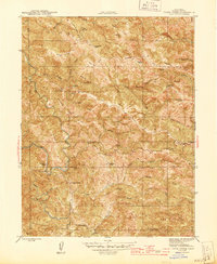
1945 Map of Tombs Creek
USGS Topo · Published 1945About this map
Wickersham Ranch and several other family-named holdings anchor this mid-1940s survey of the northern Sonoma County interior. The landscape is defined by the winding course of the Wheatfield Fork of the Gualala River and the deeply incised valleys of Tombs Creek and House Creek. Settlement is sparse and largely rural, centered on established sites like the Lee Nobles Ranch, Dickson Ranch, and the small community of Walters.
Find a feature on this map
54 named features on this map. Tap any name to fly to it.
Don’t see what you’re looking for? This feature index may not catch every label — zoom into the map to look around manually.
Map Details
Editions of this 1945 Tombs Creek Map
This is the sole edition of this map. No revisions or reprints were ever made.
Other maps of this area

1921 · Skaggs
USGS Topo · 1:62,500

1921 · Plantation
USGS Topo · 1:62,500

1938 · Hopland
USGS Topo · 1:62,500

1943 · Tombs Creek
USGS Topo · 1:24,000

1943 · Plantation
USGS Topo · 1:24,000

1943 · Cazadero
USGS Topo · 1:24,000

1943 · Annapolis
USGS Topo · 1:24,000

1943 · Skaggs Springs
USGS Topo · 1:24,000

1943 · Fort Ross
USGS Topo · 1:24,000

1943 · Hopland
USGS Topo · 1:62,500