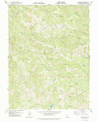
1978 Map of Tombs Creek
USGS Topo · Published 1978About this map
Wickersham Ranch and Moffitt Ranch sit within the complex ridgelines of northwestern Sonoma County, part of a rugged coastal landscape defined by the drainage systems of the Fork Gualala River. The terrain is characterized by a dense network of named ridges like Sheep Repose Ridge, Black Oak Ridge, and Walters Ridge, which divide the many seasonal and permanent watercourses. The 1978 edition reveals a region largely shaped by historic land use and geology, featuring landmarks such as Quicksilver Flat, suggesting past mining interests, and the remote outpost of Las Lomas. Cattle ranching and water management are evident through the numerous springs like Johnny Brown Springs and the naming of local landmarks such as Wild Cattle Creek and Bull Opening. Transport across this difficult geography was primarily facilitated by an extensive system of fire roads and a Trail network winding through peaks like Buck Mountain and Big Mountain.
Find a feature on this map
72 named features on this map. Tap any name to fly to it.
Don’t see what you’re looking for? This feature index may not catch every label — zoom into the map to look around manually.
Map Details
Editions of this 1978 Tombs Creek Map
This is the sole edition of this map. No revisions or reprints were ever made.
Other maps of this area

1921 · Skaggs
USGS Topo · 1:62,500

1921 · Plantation
USGS Topo · 1:62,500

1938 · Hopland
USGS Topo · 1:62,500

1943 · Tombs Creek
USGS Topo · 1:24,000

1943 · Plantation
USGS Topo · 1:24,000

1943 · Cazadero
USGS Topo · 1:24,000

1943 · Annapolis
USGS Topo · 1:24,000

1943 · Skaggs Springs
USGS Topo · 1:24,000

1943 · Fort Ross
USGS Topo · 1:24,000

1943 · Hopland
USGS Topo · 1:62,500