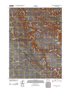
2011 Map of Tombstone Canyon
USGS Topo · Published 2011About this map
Donner und Blitzen River flows through this corner of Harney County, carving a path through the high desert alongside its major tributary, the Little Blitzen River. This landscape is defined by its water management and ranching history, centered around the Riddle Ranch and the specialized catchments of Tombstone Reservoir and Fred Riddles Reservoir. The map illustrates a high-desert environment where water sources like Big Spring and Indian Spring Creek are vital lifelines, and drainage patterns are recorded through Tombstone Canyon and Cold Spring Canyon. Transportation and access are facilitated by Steens Mountain Rd, which provides entry to the river crossings at Blitzen Crossing and Bradeen Crossing. The southern portion of the sheet highlights the transition from the river corridor to recreational areas at the Blitzen Crossing Campground, showcasing the modern balance of preservation and utility in this remote drainage basin.
Find a feature on this map
18 named features on this map. Tap any name to fly to it.
Don’t see what you’re looking for? This feature index may not catch every label — zoom into the map to look around manually.
Map Details
Editions of this 2011 Tombstone Canyon Map
This is the sole edition of this map. No revisions or reprints were ever made.
Other maps of this area

1955 · Adel
USGS Topo · 1:250,000

1957 · Adel
USGS Topo · 1:250,000

1958 · Adel
USGS Topo · 1:250,000

1962 · Adel
USGS Topo · 1:250,000

1967 · Roaring Springs
USGS Topo · 1:24,000

1967 · Frenchglen
USGS Topo · 1:24,000

1967 · Page Springs
USGS Topo · 1:24,000

1968 · Tombstone Canyon
USGS Topo · 1:24,000

1968 · Fish Lake
USGS Topo · 1:24,000

1968 · Roaring Springs SE
USGS Topo · 1:24,000