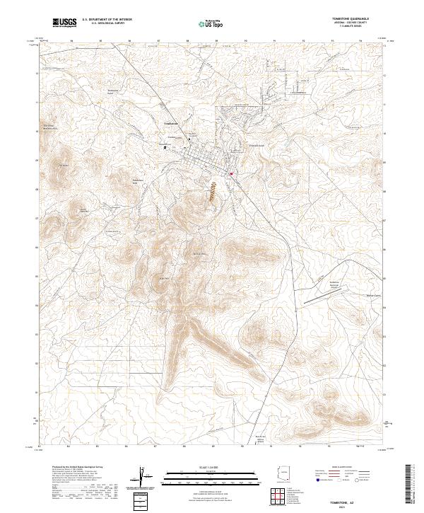
2021 Map of Tombstone
USGS Topo · Published 2021About this map
Tombstone remains the focal point of this desert landscape, its grid of streets laid out over the mineral-rich terrain of Cochise County. The map details the proximity of the town to several prominent peaks, including Comstock Hill and the Tombstone Hills, reflecting the area's deep ties to silver mining and prospecting. Notable for genealogists and historians is the presence of the Boothill Graveyard north of the main town site, alongside the Tombstone Cemetery, serving as vital markers of the settlement's frontier past. Beyond the urban center, the geography is defined by numerous seasonal drainages such as Tombstone Gulch, Emerald Gulch, and Walnut Gulch. The southern portion of the quadrangle shows modern developments like the Tombstone Municipal Airport and the Rancho San Marcos Airport, while the surrounding hills like Uncle Sam Hill and Military Hill continue to dominate the horizon.
Find a feature on this map
77 named features on this map. Tap any name to fly to it.
Don’t see what you’re looking for? This feature index may not catch every label — zoom into the map to look around manually.
Map Details
Editions of this 2021 Tombstone Map
This is the sole edition of this map. No revisions or reprints were ever made.
Other maps of this area

1915 · Benson
USGS Topo · 1:125,000

1916 · Pearce
USGS Topo · 1:125,000

1922 · St. David
USGS Topo · 1:62,500

1925 · Gleeson
USGS Topo · 1:62,500

1926 · Courtland
USGS Topo · 1:62,500

1932 · Fairbank
USGS Topo · 1:62,500

1943 · Benson
USGS Topo · 1:125,000

1952 · Tombstone SE
USGS Topo · 1:24,000
1952 · Lewis Springs
USGS Topo · 1:24,000
1952 · Fairbank
USGS Topo · 1:24,000