
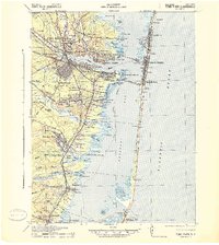
1941 Map of Toms River
USGS Topo · Published 1941About this map
Toms River flows into the expansive Barnegat Bay, anchoring a landscape defined by the coastal settlements of the Jersey Shore during the early 1940s. The region is characterized by established riverfront towns like Island Heights, Pine Beach, and Beachwood, contrasted with the narrow barrier beach communities of Seaside Heights and Lavallette. Significant local landmarks include the Royal Pines Hospital and the State Game Farm, while the Pennsylvania railroad network provides a glimpse into the era's transportation infrastructure, even as some segments are already marked as Abandoned.
Find a feature on this map
100 named features on this map. Tap any name to fly to it.
Don’t see what you’re looking for? This feature index may not catch every label — zoom into the map to look around manually.
Map Details
Editions of this 1941 Toms River Map
2 editions found
Other maps of this area

1884 · Whitings
USGS Topo · 1:62,500

1888 · Barnegat
USGS Topo · 1:62,500

1888 · Little Egg Harbor
USGS Topo · 1:62,500

1888 · Asbury Park
USGS Topo · 1:62,500

1888 · Cassville
USGS Topo · 1:62,500

1888 · Long Beach
USGS Topo · 1:62,500

1888 · Whitings
USGS Topo · 1:62,500

1893 · Little Egg Harbor
USGS Topo · 1:62,500

1893 · Asbury Park
USGS Topo · 1:62,500

1893 · Long Beach
USGS Topo · 1:62,500