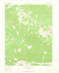
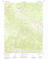
1961 Map of Toner Reservoir
USGS Topo · Published 1963About this map
White River National Forest lands dominate this 1961 survey, where the dramatic terrain of Red Table Mountain gives way to the narrow valley of the Fryingpan River. The map illustrates a landscape of managed resources and remote outposts, featuring the State Fish and Game Station and several isolated residential sites like Duffs Cabin. The southern corridor along the river is the primary hub of activity, where the The Camp Ditch and local ranches like Castle View Ranch and Cap-K-Ranch sit at the base of the Seven Castles rock formations. High-country water management is evident through a network of alpine reservoirs and lakes, including Toner Reservoir, Sundell Reservoir, and the clusters of Sourdough Lakes and Cherry Lake. These features are connected by a network of pack trails and jeep trails that navigate the high passes.
Find a feature on this map
47 named features on this map. Tap any name to fly to it.
Don’t see what you’re looking for? This feature index may not catch every label — zoom into the map to look around manually.
Map Details
Editions of this 1961 Toner Reservoir Map
5 editions found
Other maps of this area

1909 · Mount Jackson
USGS Topo · 1:125,000

1911 · Mount Jackson
USGS Topo · 1:125,000

1927 · Glenwood Springs
USGS Topo · 1:125,000

1930 · Glenwood Springs
USGS Topo · 1:125,000

1957 · Leadville
USGS Topo · 1:250,000

1959 · Leadville
USGS Topo · 1:250,000

1960 · Leadville
USGS Topo · 1:250,000

1961 · Leon
USGS Topo · 1:24,000

1961 · Basalt
USGS Topo · 1:24,000

1961 · Cottonwood Pass
USGS Topo · 1:24,000