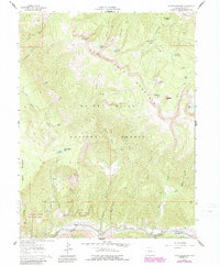
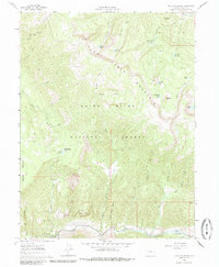
1961 Map of Toner Reservoir
USGS Topo · Published 1988About this map
Red Table Mountain dominates the high-altitude terrain of Eagle County, Colorado, within the White River National Forest. Surveyed in the early 1960s with 1980s updates, this landscape is defined by its complex network of water management and high-country landmarks. The Fryingpan River flows along the southern edge, supported by irrigation infrastructure like the Camp Ditch. High basins are dotted with natural and man-made water bodies, including Toner Reservoir, Sundell Reservoir, and the Sourdough Lakes. Historically, the area reflects a mix of rugged recreation and resource management, evidenced by Duffs Cabin and numerous named pack trails. The distinct geological formation of the Seven Castles stands near the river, while the Christine State Wildlife Area marks a dedicated zone for conservation along the western boundary.
Find a feature on this map
40 named features on this map. Tap any name to fly to it.
Don’t see what you’re looking for? This feature index may not catch every label — zoom into the map to look around manually.
Map Details
Editions of this 1961 Toner Reservoir Map
5 editions found
Other maps of this area

1909 · Mount Jackson
USGS Topo · 1:125,000

1911 · Mount Jackson
USGS Topo · 1:125,000

1927 · Glenwood Springs
USGS Topo · 1:125,000

1930 · Glenwood Springs
USGS Topo · 1:125,000

1957 · Leadville
USGS Topo · 1:250,000

1959 · Leadville
USGS Topo · 1:250,000

1960 · Leadville
USGS Topo · 1:250,000

1961 · Leon
USGS Topo · 1:24,000

1961 · Basalt
USGS Topo · 1:24,000

1961 · Cottonwood Pass
USGS Topo · 1:24,000