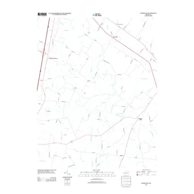
2013 Map of Tonieville
USGS Topo · Published 2013About this map
Tonieville serves as the central hub of this northern Larue County landscape, where the Nolin River and its various forks carve through the terrain. The presence of Eagle Mills and Mathers Mill suggests a history tied to water-powered industry along these drainage systems. The map details a transition from the busier corridor near Glendale Junction in the west to more quiet agricultural stretches in the east. Genealogy and local history researchers can identify family-named roads and burial sites such as Williams Cem near Hornback Airport and Big Spring Cem situated near Middle Cr. The confluence of the N Fork Nolin River and S Fork Nolin River creates a complex network of waterways that historically influenced local travel and settlement patterns in this part of Kentucky.
Find a feature on this map
73 named features on this map. Tap any name to fly to it.
Don’t see what you’re looking for? This feature index may not catch every label — zoom into the map to look around manually.
Map Details
Editions of this 2013 Tonieville Map
This is the sole edition of this map. No revisions or reprints were ever made.
Other maps of this area

1934 · Munfordville
USGS Topo · 1:48,000

1935 · Elizabethtown
USGS Topo · 1:48,000

1937 · Munfordville
USGS Topo · 1:62,500

1938 · Elizabethtown
USGS Topo · 1:62,500

1948 · Cecilia
USGS Topo · 1:24,000

1949 · Sonora
USGS Topo · 1:24,000

1949 · Tonieville
USGS Topo · 1:24,000

1949 · Elizabethtown
USGS Topo · 1:24,000
1949 · Elizabethtown
USGS Topo · 1:62,500

1953 · Nelsonville
USGS Topo · 1:24,000