
1949 Map of Tonieville
USGS Topo · Published 1952About this map
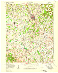
Nolin River winds through the heart of the central Kentucky landscape, defining a rural economy built on the water and the rails in the late 1940s. The Illinois Central Railroad cuts across the northern portion of the sheet, passing through Tonieville and near the Osborne Quarry. Local life centers on scattered settlements and mills, such as Eagle Mills and Mathers Mill, alongside a network of country schools including Siberia Sch and Crossroads Sch.
Find a feature on this map
37 named features on this map. Tap any name to fly to it.
Don’t see what you’re looking for? This feature index may not catch every label — zoom into the map to look around manually.
Map Details
Editions of this 1949 Tonieville Map
This is the sole edition of this map. No revisions or reprints were ever made.
Other maps of this area

1934 · Munfordville
USGS Topo · 1:48,000

1935 · Elizabethtown
USGS Topo · 1:48,000

1937 · Munfordville
USGS Topo · 1:62,500

1938 · Elizabethtown
USGS Topo · 1:62,500

1948 · Cecilia
USGS Topo · 1:24,000

1949 · Sonora
USGS Topo · 1:24,000

1949 · Elizabethtown
USGS Topo · 1:24,000
1949 · Elizabethtown
USGS Topo · 1:62,500

1953 · Nelsonville
USGS Topo · 1:24,000

1953 · Magnolia
USGS Topo · 1:24,000