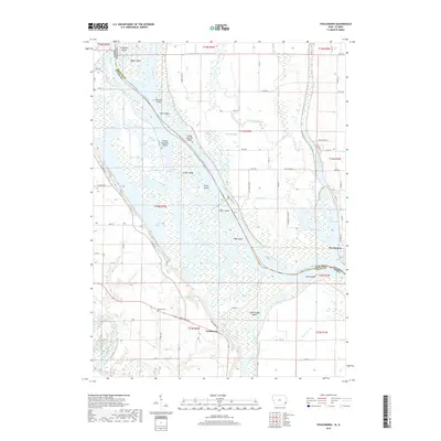
2018 Map of Toolesboro
USGS Topo · Published 2018About this map
The Mississippi River and the Iowa River converge in this detailed mapping of the border between Illinois and Iowa, where the river's dynamic nature is visible through an intricate network of chutes, islands, and sloughs. On the Illinois bank, the town of New Boston sits adjacent to Boston Bay and Sturgeon Bay, while the Iowa side features the settlement of Toolesboro and the sprawling waters of Lake 28 Odesa.
Find a feature on this map
79 named features on this map. Tap any name to fly to it.
Don’t see what you’re looking for? This feature index may not catch every label — zoom into the map to look around manually.
Map Details
Editions of this 2018 Toolesboro Map
This is the sole edition of this map. No revisions or reprints were ever made.
Other maps of this area

1916 · Edgington
USGS Topo · 1:62,500

1935 · Keithsburg
USGS Topo · 1:48,000

1938 · Edgington
USGS Topo · 1:62,500

1941 · Keithsburg
USGS Topo · 1:62,500

1946 · Wapello
USGS Topo · 1:62,500

1948 · Muscatine
USGS Topo · 1:62,500

1949 · Wapello
USGS Topo · 1:62,500

1953 · Toolesboro
USGS Topo · 1:24,000

1953 · Blanchard Island
USGS Topo · 1:24,000
1953 · Eliza
USGS Topo · 1:24,000