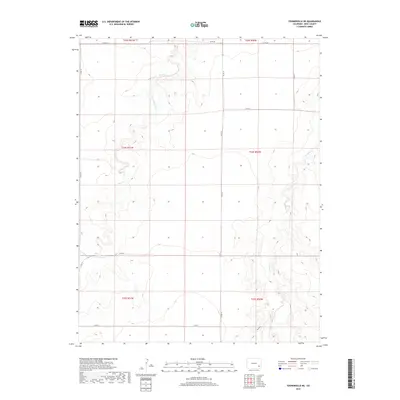
2019 Map of Toonerville NE
USGS Topo · Published 2019About this map
Rule Cr and the seasonal drainages of Caddoa Cr define this section of the High Plains in Bent County, where the landscape is organized by the rigid grid of the Public Land Survey System. The map documents an area dominated by dryland ranching and water management, notably featuring the Poor Mans Ditch which cuts through the northern sections. This irrigation feature suggests the historical efforts of local settlers to divert water across the arid terrain. The infrastructure is characterized by a sparse network of county roads, including Co Rd BB and Co Rd 16, which follow township and range lines. The topography is shaped by gradual elevation changes and the erosive paths of ephemeral waterways like Hood Draw, illustrating the relationship between the natural drainage patterns and the engineered livestock and agricultural landscape of eastern Colorado.
Find a feature on this map
17 named features on this map. Tap any name to fly to it.
Don’t see what you’re looking for? This feature index may not catch every label — zoom into the map to look around manually.
Map Details
Editions of this 2019 Toonerville NE Map
This is the sole edition of this map. No revisions or reprints were ever made.
Other maps of this area

1891 · Higbee
USGS Topo · 1:125,000

1891 · Las Animas
USGS Topo · 1:125,000

1892 · Lamar
USGS Topo · 1:125,000

1892 · Two Butte
USGS Topo · 1:125,000

1893 · Higbee
USGS Topo · 1:125,000

1893 · Two Butte
USGS Topo · 1:125,000

1893 · Las Animas
USGS Topo · 1:125,000

1953 · Hasty
USGS Topo · 1:24,000

1953 · Las Animas
USGS Topo · 1:24,000

1953 · Kreybill
USGS Topo · 1:24,000