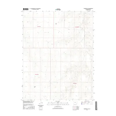
2016 Map of Toonerville SE
USGS Topo · Published 2016About this map
Caddoa Cr meanders through the eastern portion of this southeastern Colorado landscape, defining the drainage patterns of this high plains environment. The terrain is characterized by a series of intermittent waterways and significant topographical draws, including Hood Draw in the north and Penrose Draw to the southwest. These features reflect the natural erosional forces typical of Bent County, where seasonal water flow dictates the shape of the land. A sparse but intentional grid of section lines and rural roads, such as Co RD 19 and Co RD R, provides the primary structure for land management and travel across this open country. The presence of Sniff Cr further illustrates the complex network of ephemeral streams that support the local ecosystem and agricultural potential of the region during the early twenty-first century.
Find a feature on this map
13 named features on this map. Tap any name to fly to it.
Don’t see what you’re looking for? This feature index may not catch every label — zoom into the map to look around manually.
Map Details
Editions of this 2016 Toonerville SE Map
This is the sole edition of this map. No revisions or reprints were ever made.
Other maps of this area

1891 · Higbee
USGS Topo · 1:125,000

1892 · Two Butte
USGS Topo · 1:125,000

1893 · Higbee
USGS Topo · 1:125,000

1893 · Two Butte
USGS Topo · 1:125,000

1955 · La Junta
USGS Topo · 1:250,000

1958 · La Junta
USGS Topo · 1:250,000

1966 · Toonerville SE
USGS Topo · 1:24,000
1966 · Gilpin
USGS Topo · 1:24,000
1966 · Toonerville
USGS Topo · 1:24,000
1966 · Toonerville NE
USGS Topo · 1:24,000