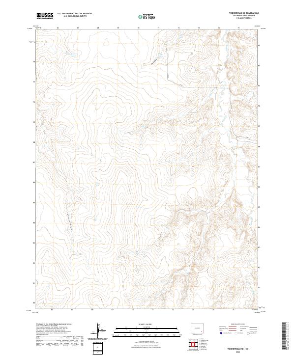
2022 Map of Toonerville SE
USGS Topo · Published 2022About this map
Caddoa Cr and Sniff Cr define the drainage patterns of this southeastern Colorado landscape in Bent County. The terrain is characterized by expansive draws and intermittent waterways, such as Hood Draw and Penrose Draw, which cut through the high plains. The map illustrates a strictly rural infrastructure, where the section lines of the Public Land Survey System dictate the placement of local thoroughfares like Co Rd 16 and Co Rd N. These gravel and dirt routes serve as the primary conduits for ranching and agricultural access across the townships of T25S and T26S. This topographical study highlights the relationship between the natural contours of the draws and the rigid grid of county roads, reflecting the 21st-century management of open range and private landholdings in the region.
Find a feature on this map
13 named features on this map. Tap any name to fly to it.
Don’t see what you’re looking for? This feature index may not catch every label — zoom into the map to look around manually.
Map Details
Editions of this 2022 Toonerville SE Map
This is the sole edition of this map. No revisions or reprints were ever made.
Other maps of this area

1891 · Higbee
USGS Topo · 1:125,000

1892 · Two Butte
USGS Topo · 1:125,000

1893 · Higbee
USGS Topo · 1:125,000

1893 · Two Butte
USGS Topo · 1:125,000

1955 · La Junta
USGS Topo · 1:250,000

1958 · La Junta
USGS Topo · 1:250,000

1966 · Toonerville SE
USGS Topo · 1:24,000
1966 · Gilpin
USGS Topo · 1:24,000
1966 · Toonerville
USGS Topo · 1:24,000
1966 · Toonerville NE
USGS Topo · 1:24,000