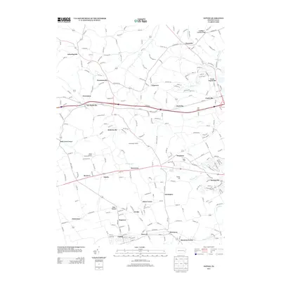
2013 Map of Topton
USGS Topo · Published 2013About this map
Topton and Fogelsville anchor a landscape defined by traditional Pennsylvania German settlement patterns and modern agricultural research. The map captures the specialized footprint of the Rodale Institute Experimental Farm near Monterey, documenting a site central to the history of organic farming. Numerous small communities such as Hynemansville, New Smithville, and Mertztown are scattered across the terrain, reflecting the region's dense network of early crossroads and post villages.
Find a feature on this map
45 named features on this map. Tap any name to fly to it.
Don’t see what you’re looking for? This feature index may not catch every label — zoom into the map to look around manually.
Map Details
Editions of this 2013 Topton Map
This is the sole edition of this map. No revisions or reprints were ever made.
Other maps of this area

1894 · Reading
USGS Topo · 1:62,500

1902 · Boyertown
USGS Topo · 1:62,500

1902 · Slatington
USGS Topo · 1:62,500

1909 · Hamburg
USGS Topo · 1:62,500

1911 · Hamburg
USGS Topo · 1:62,500

1913 · Reading
USGS Topo · 1:62,500

1915 · Reading
USGS Topo · 1:62,500
1937 · Allentown West
USGS Topo · 1:48,000
1942 · Allentown West
USGS Topo · 1:62,500
1943 · Manatawny
USGS Topo · 1:31,680
Featured Places
- Maxatawny Township, PA
- Longswamp Township, PA
- Weisenberg Township, PA
- Topton, PA
- Hancock, Longswamp Township