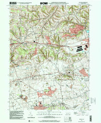
1999 Map of Topton
USGS Topo · Published 2001About this map
The boundary between Lehigh and Berks Counties runs through this landscape of early Pennsylvania settlements and agricultural crossroad communities. In the southern portion, the borough of Topton sits adjacent to Ringtown, while the rail corridor near Shamrock Station and Mertztown highlights the region's historic transportation infrastructure. Educational and spiritual life are anchored by the Weisenberg School, Township School, and churches such as St Pauls Church and Ziegel Church.
Find a feature on this map
64 named features on this map. Tap any name to fly to it.
Don’t see what you’re looking for? This feature index may not catch every label — zoom into the map to look around manually.
Map Details
Editions of this 1999 Topton Map
This is the sole edition of this map. No revisions or reprints were ever made.
Other maps of this area

1894 · Reading
USGS Topo · 1:62,500

1902 · Boyertown
USGS Topo · 1:62,500

1902 · Slatington
USGS Topo · 1:62,500

1909 · Hamburg
USGS Topo · 1:62,500

1911 · Hamburg
USGS Topo · 1:62,500

1913 · Reading
USGS Topo · 1:62,500

1915 · Reading
USGS Topo · 1:62,500

1937 · Allentown West
USGS Topo · 1:48,000

1942 · Allentown West
USGS Topo · 1:62,500

1943 · Manatawny
USGS Topo · 1:31,680