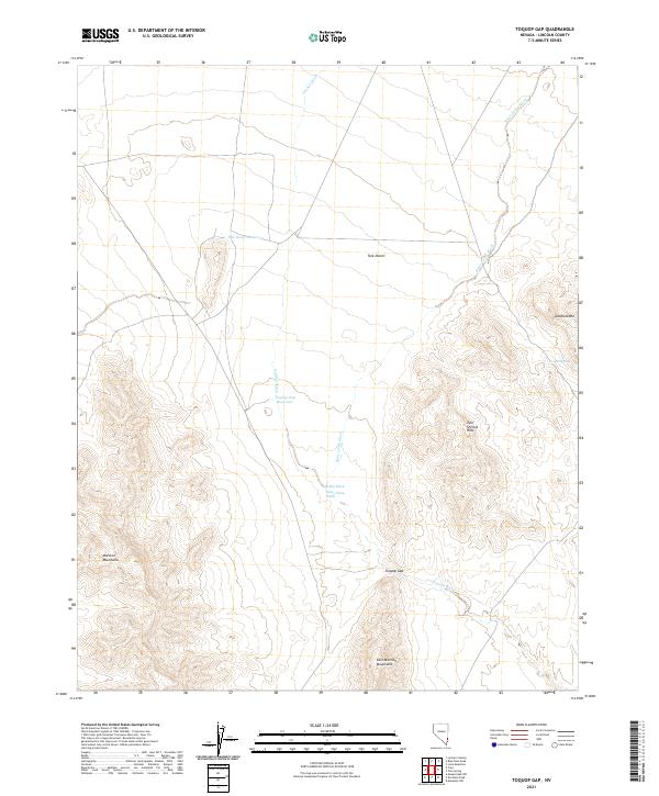
2021 Map of Toquop Gap
USGS Topo · Published 2021About this map
Tule Desert dominates the landscape of this corner of Lincoln County, defined by a network of drainage systems that cut through the surrounding high ground. The interaction of water and desert topography is evident in the presence of the Toquop Gap Reservoir and Tule Desert Reservoir, which collect seasonal runoff from the Garden Wash and Sams Camp Wash. These features, along with Summit Spring, represent vital water points in a demanding environment. The terrain is framed by the steep rises of the Mormon Mountains to the southwest and the East Mormon Mountains to the south, while the Tule Springs Hills and the aptly named Jumbled Mtn mark the eastern reaches. The namesake Toquop Gap serves as a primary geographic transition point where Toquop Wash exits the upland slopes and moves toward the desert floor.
Find a feature on this map
18 named features on this map. Tap any name to fly to it.
Don’t see what you’re looking for? This feature index may not catch every label — zoom into the map to look around manually.
Map Details
Editions of this 2021 Toquop Gap Map
This is the sole edition of this map. No revisions or reprints were ever made.
Other maps of this area

1885 · Pioche
USGS Topo · 1:250,000

1886 · Saint Thomas
USGS Topo · 1:250,000

1886 · Pioche
USGS Topo · 1:250,000

1893 · Saint Thomas
USGS Topo · 1:250,000

1954 · Caliente
USGS Topo · 1:250,000

1954 · Las Vegas
USGS Topo · 1:250,000

1957 · Las Vegas
USGS Topo · 1:250,000

1957 · Mesquite
USGS Topo · 1:62,500

1959 · Caliente
USGS Topo · 1:250,000

1959 · Las Vegas
USGS Topo · 1:250,000