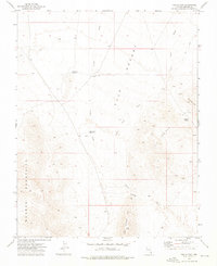
1973 Map of Toquop Gap
USGS Topo · Published 1976About this map
Tule Desert and its surrounding mountain ranges dominate this 1970s topographic study of Lincoln County. The arid landscape is defined by drainage patterns like Garden Wash and Sams Camp Wash, which flow toward the rugged Mormon Mountains and East Mormon Mts. This era of surveying captures the critical water infrastructure required for survival in the high desert, including the Tule Desert Well, Toquop Gap Reservoir, and Tule Desert Reservoir. These features, along with Summit Spring, suggest a landscape managed for cattle or transit through the Gap. The presence of a single Prospect near Jumbled Mtn in the Tule Springs Hills indicates the persistent search for mineral wealth in the carbonate rocks of southeastern Nevada, while numerous Jeep Trails crisscrossing the terrain show the modern accessibility of this desert interior.
Find a feature on this map
16 named features on this map. Tap any name to fly to it.
Don’t see what you’re looking for? This feature index may not catch every label — zoom into the map to look around manually.
Map Details
Editions of this 1973 Toquop Gap Map
This is the sole edition of this map. No revisions or reprints were ever made.
Other maps of this area

1885 · Pioche
USGS Topo · 1:250,000

1886 · Saint Thomas
USGS Topo · 1:250,000

1886 · Pioche
USGS Topo · 1:250,000

1893 · Saint Thomas
USGS Topo · 1:250,000

1954 · Caliente
USGS Topo · 1:250,000

1954 · Las Vegas
USGS Topo · 1:250,000

1957 · Las Vegas
USGS Topo · 1:250,000

1957 · Mesquite
USGS Topo · 1:62,500

1959 · Caliente
USGS Topo · 1:250,000

1959 · Las Vegas
USGS Topo · 1:250,000