2022 Map of Toronto
USGS Topo · Published 2022About this map
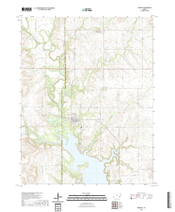
The town of Toronto, Kansas, serves as the central hub of this landscape, positioned just north of the extensive Toronto Lake. This 2022 survey captures the interaction between the town's grid, including E Main St, and the surrounding rural terrain marked by the Verdigris River and its numerous tributaries such as Walnut Creek and Cedar Creek. The geography is defined by a series of drainages and notable elevations like Biscuit Mound, which stands out against the hollows and creek beds.
Find a feature on this map
40 named features on this map. Tap any name to fly to it.
Don’t see what you’re looking for? This feature index may not catch every label — zoom into the map to look around manually.
Map Details
Editions of this 2022 Toronto Map
This is the sole edition of this map. No revisions or reprints were ever made.