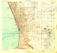
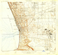
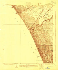
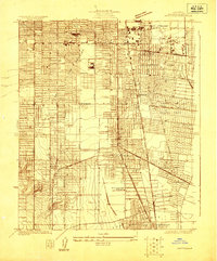
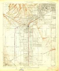
1924 Map of Torrance
USGS Topo · Published 1924About this map
Torrance stands as a burgeoning industrial center in the mid-1920s, dominated by the sprawling Pacific Electric Car Shops and heavy industry such as the Llewellyn Iron Works and Union Tool Co. This survey captures the South Bay during a period of rapid transition, where the coastal leisure of Manhattan Beach, Hermosa Beach, and Redondo Beach meets an interior landscape shaped by the Pacific Electric rail lines. The northern section reveals the agricultural roots of the area through the Sausal Redondo region and the small settlements of Lawndale and Moneta. Along the coast, significant infrastructure like the Edison Intake Pier and the Pacific Electric Pier highlight the era's engineering, while the southern bluffs of Los Palos Verdes rise above Malaga Cove, marking the natural boundary of the coastal plain.
Find a feature on this map
37 named features on this map. Tap any name to fly to it.
Don’t see what you’re looking for? This feature index may not catch every label — zoom into the map to look around manually.
Map Details
Editions of this 1924 Torrance Map
2 editions found
Other maps of this area

1896 · Redondo
USGS Topo · 1:62,500

1901 · Southern California Sheet No. 1
USGS Topo · 1:250,000

1904 · Southern California Sheet No. 1
USGS Topo · 1:250,000
1923 · Venice
USGS Topo · 1:24,000

1923 · Wilmington
USGS Topo · 1:24,000
1923 · Watts
USGS Topo · 1:24,000
1924 · Inglewood
USGS Topo · 1:24,000
1924 · Venice
USGS Topo · 1:24,000

1924 · Compton
USGS Topo · 1:24,000

1924 · Watts
USGS Topo · 1:24,000