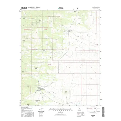
2017 Map of Torreon
USGS Topo · Published 2017About this map
The Manzano Mountains anchor the western edge of this landscape, where the high-altitude terrain of the Cibola National Forest descends into a series of deeply cut canyons. Settlements like Torreon and Manzano are positioned along the eastern slopes, tracing an ancient corridor of habitation sustained by reliable water sources such as Torreon Spring. The map documents a cluster of historical burial sites near these villages, including the Torreon Catholic Cem and Manzano Churchyard Cem, which serve as vital markers for genealogical research in Torrance County.
Find a feature on this map
113 named features on this map. Tap any name to fly to it.
Don’t see what you’re looking for? This feature index may not catch every label — zoom into the map to look around manually.
Map Details
Editions of this 2017 Torreon Map
This is the sole edition of this map. No revisions or reprints were ever made.
Other maps of this area

1917 · Estancia
USGS Topo · 1:125,000

1954 · Bosque Peak
USGS Topo · 1:24,000

1954 · Capilla Peak
USGS Topo · 1:24,000

1954 · Torreon
USGS Topo · 1:24,000

1954 · Tajique
USGS Topo · 1:24,000

1954 · Milbourn Ranch
USGS Topo · 1:24,000

1954 · Torreon
USGS Topo · 1:62,500

1954 · Socorro
USGS Topo · 1:250,000

1956 · Estancia
USGS Topo · 1:62,500

1956 · Mountainair
USGS Topo · 1:62,500