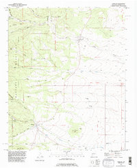
1991 Map of Torreon
USGS Topo · Published 1995About this map
Cibola National Forest defines the western edge of this landscape, where the high terrain of Comanche Ridge descends into a series of deep canyons and seasonal arroyos. The map documents the persistent agricultural and ranching heritage of Torrance County through a distinct pattern of family-named sites, including Chaves Place, Bermudez Place, and Candelaria Place. These individual homesteads are scattered between the larger settlements of Torreon and Manzano, both of which are situated within their respective Spanish land grant boundaries.
Find a feature on this map
44 named features on this map. Tap any name to fly to it.
Don’t see what you’re looking for? This feature index may not catch every label — zoom into the map to look around manually.
Map Details
Editions of this 1991 Torreon Map
This is the sole edition of this map. No revisions or reprints were ever made.
Other maps of this area

1917 · Estancia
USGS Topo · 1:125,000

1954 · Bosque Peak
USGS Topo · 1:24,000

1954 · Capilla Peak
USGS Topo · 1:24,000

1954 · Torreon
USGS Topo · 1:24,000

1954 · Tajique
USGS Topo · 1:24,000

1954 · Milbourn Ranch
USGS Topo · 1:24,000

1954 · Torreon
USGS Topo · 1:62,500

1954 · Socorro
USGS Topo · 1:250,000

1956 · Estancia
USGS Topo · 1:62,500

1956 · Mountainair
USGS Topo · 1:62,500