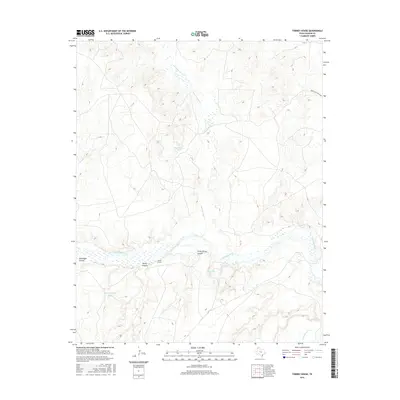
2016 Map of Torrey House
USGS Topo · Published 2016About this map
Torrey House sits at the heart of this landscape where the Canadian River cuts through the high plains of Oldham County. The terrain is defined by deep breaks and seasonal watercourses, including the notable Little Torrey Canyon and Torrey Canyon that drain toward the river's path. These natural features provided essential shelter and water in an arid environment, a fact reflected in the presence of several water management sites like Rita Blanca Tank and the Old Goodnight Tank.
Find a feature on this map
13 named features on this map. Tap any name to fly to it.
Don’t see what you’re looking for? This feature index may not catch every label — zoom into the map to look around manually.
Map Details
Editions of this 2016 Torrey House Map
This is the sole edition of this map. No revisions or reprints were ever made.
Other maps of this area

1954 · Tucumcari
USGS Topo · 1:250,000

1958 · Tucumcari
USGS Topo · 1:250,000

1966 · Alamocitos Camp
USGS Topo · 1:24,000

1966 · Halfway Creek
USGS Topo · 1:24,000

1966 · Torrea Peak
USGS Topo · 1:24,000

1971 · Proctor Ranch
USGS Topo · 1:24,000

1971 · Channing NW
USGS Topo · 1:24,000

1971 · Many Post Camp
USGS Topo · 1:24,000

1971 · Boys Ranch West
USGS Topo · 1:24,000
1971 · Torrey House
USGS Topo · 1:24,000