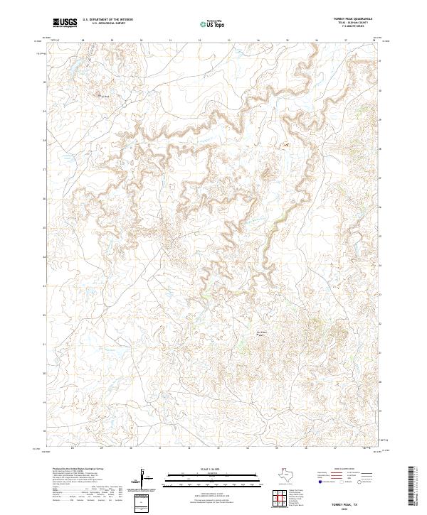
2022 Map of Torrey Peak
USGS Topo · Published 2022About this map
Torrey Peak rises above a highly dissected landscape of the Texas Panhandle, where the erosional power of the Alamosa Creek system has carved deep relief into the high plains. This 2022 survey documents the intricate drainage network of Alamosa Cr and its primary tributaries, including W Alamosa Cr and Middle Alamosa Cr. The terrain is characterized by complex canyon formations, most notably at Torrey Canyon and the expansive breaks known as The Cedar Brakes. These landforms reveal the stark geological transitions of Oldham County, where water is the primary architect of the land. Ranching infrastructure is evident through named water catchments like Big Torrey Tank and Antelope Tank, which are vital in this arid environment. The map also traces more isolated drainages such as Billys Creek and Ledger Cr, providing a precise record of the seasonal watercourses that define the region's topography.
Find a feature on this map
14 named features on this map. Tap any name to fly to it.
Don’t see what you’re looking for? This feature index may not catch every label — zoom into the map to look around manually.
Map Details
Editions of this 2022 Torrey Peak Map
This is the sole edition of this map. No revisions or reprints were ever made.
Other maps of this area

1954 · Tucumcari
USGS Topo · 1:250,000

1958 · Tucumcari
USGS Topo · 1:250,000

1966 · Alamocitos Camp
USGS Topo · 1:24,000

1966 · Jay Taylor Ranch
USGS Topo · 1:24,000

1966 · Halfway Creek
USGS Topo · 1:24,000

1966 · Landergin
USGS Topo · 1:24,000

1966 · Torrea Peak
USGS Topo · 1:24,000
1966 · Vega North
USGS Topo · 1:24,000

1971 · Many Post Camp
USGS Topo · 1:24,000

1971 · Boys Ranch West
USGS Topo · 1:24,000