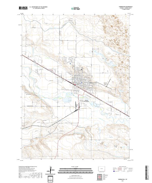
2021 Map of Torrington
USGS Topo · Published 2021About this map
The North Platte River defines the landscape of this Goshen County hub, where complex irrigation networks like the Interstate Canal, Torrington Ditch, and Rock Ranch Canal have long supported local agriculture. In Torrington, the presence of the Goshen County Courthouse and Eastern Wyoming College marks the town's role as a regional civic and educational center. The map reveals the intricate urban grid extending toward South Torrington, bridged by the BNSF Railway and major thoroughfares like Industrial Park Ave. Along the river's path, distinctive terrain features such as The Narrows appear alongside community spaces like Jirdon Park and Pioneer Park. This 2021 survey illustrates how the modern community maintains its reliance on the water systems and rail infrastructure that established the settlement's early footprint.
Find a feature on this map
97 named features on this map. Tap any name to fly to it.
Don’t see what you’re looking for? This feature index may not catch every label — zoom into the map to look around manually.
Map Details
Editions of this 2021 Torrington Map
This is the sole edition of this map. No revisions or reprints were ever made.
Other maps of this area

1896 · Patrick
USGS Topo · 1:125,000

1899 · Goshen Hole
USGS Topo · 1:125,000

1954 · Torrington
USGS Topo · 1:250,000

1954 · Cheyenne
USGS Topo · 1:250,000

1958 · Cheyenne
USGS Topo · 1:250,000

1958 · Torrington
USGS Topo · 1:250,000

1960 · Huntley
USGS Topo · 1:24,000

1960 · Lyman
USGS Topo · 1:24,000
1960 · Cottier
USGS Topo · 1:24,000
1960 · Yoder
USGS Topo · 1:24,000