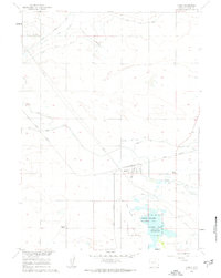
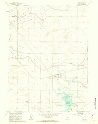
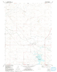
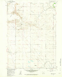
1960 Map of Yoder
USGS Topo · Published 1962About this map
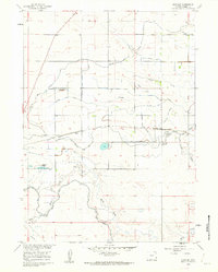
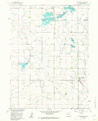
The high plains of Goshen County are defined here by a sophisticated irrigation network vital to the region's agricultural life in the early 1960s. Yoder stands as the primary rail-side settlement, situated along the Union Pacific line which cuts diagonally across the landscape. The reliance on water management is evident through the extensive system of the Fort Laramie Canal, the Goshen Hole Main Ditch, and the Cherry Creek Lateral. These man-made watercourses, along with the Perchal Drain, transformed the arid terrain surrounding landmarks like Greasewood Ranch.
Find a feature on this map
13 named features on this map. Tap any name to fly to it.
Don’t see what you’re looking for? This feature index may not catch every label — zoom into the map to look around manually.
Map Details
Editions of this 1960 Yoder Map
3 editions found
Other maps of this area

1896 · Patrick
USGS Topo · 1:125,000

1899 · Goshen Hole
USGS Topo · 1:125,000

1954 · Torrington
USGS Topo · 1:250,000

1954 · Cheyenne
USGS Topo · 1:250,000

1958 · Cheyenne
USGS Topo · 1:250,000

1958 · Torrington
USGS Topo · 1:250,000
1960 · Habig Spring
USGS Topo · 1:24,000
1960 · Huntley
USGS Topo · 1:24,000
1960 · Veteran
USGS Topo · 1:24,000
1960 · Hawk Springs
USGS Topo · 1:24,000