1960 Map of Yoder
USGS Topo · Published 1993About this map
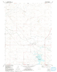
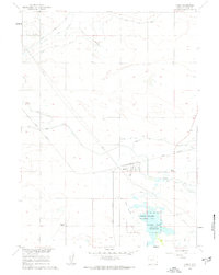
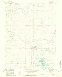
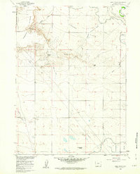
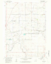
Yoder sits at the heart of this high plains landscape, serving as a primary settlement node within the irrigation-rich Goshen Hole region. This 1960 survey reflects a high-plains agricultural economy defined by an intricate network of water management features, including the Fort Laramie Canal and the Goshen Hole Ditch. The presence of the Springer Wildlife Management Unit and the adjacent Goshen Hole (Springer) Reservoir indicates the importance of these man-made water systems for both conservation and local utility. Away from the centralized irrigation works, the terrain is dotted with isolated landmarks like Greasewood Ranch and various laterals such as the Cherry Creek Lateral, illustrating how the land was systematically divided and reclaimed for ranching and farming in the mid-20th century.
Find a feature on this map
13 named features on this map. Tap any name to fly to it.
Don’t see what you’re looking for? This feature index may not catch every label — zoom into the map to look around manually.
Map Details
Editions of this 1960 Yoder Map
3 editions found
Other maps of this area

1896 · Patrick
USGS Topo · 1:125,000

1899 · Goshen Hole
USGS Topo · 1:125,000

1954 · Torrington
USGS Topo · 1:250,000

1954 · Cheyenne
USGS Topo · 1:250,000

1958 · Cheyenne
USGS Topo · 1:250,000

1958 · Torrington
USGS Topo · 1:250,000
1960 · Habig Spring
USGS Topo · 1:24,000
1960 · Huntley
USGS Topo · 1:24,000
1960 · Veteran
USGS Topo · 1:24,000
1960 · Hawk Springs
USGS Topo · 1:24,000