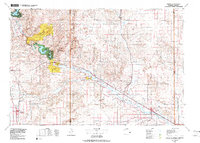
1978 Map of Torrington
USGS Topo · Published 1978About this map
Fort Laramie National Historic Site stands as a central landmark in this 1970s survey of eastern Wyoming and the Nebraska border. The landscape is defined by the North Platte River corridor, which supported both the westward expansion along the Emigrant Trail and the later development of the Burlington Northern and Union Pacific railroads. Significant water management and recreation areas are evident at Glendo Reservoir and Guernsey Reservoir, which are flanked by Glendo State Park and Guernsey State Park.
Find a feature on this map
42 named features on this map. Tap any name to fly to it.
Don’t see what you’re looking for? This feature index may not catch every label — zoom into the map to look around manually.
Map Details
Editions of this 1978 Torrington Map
2 editions found
Other maps of this area

1896 · Patrick
USGS Topo · 1:125,000

1896 · Hartville
USGS Topo · 1:125,000

1898 · Scotts Bluff
USGS Topo · 1:125,000

1899 · Goshen Hole
USGS Topo · 1:125,000

1899 · Whistle Creek
USGS Topo · 1:125,000

1901 · Hartville
USGS Topo · 1:125,000

1949 · Cedar Top
USGS Topo · 1:24,000

1950 · Glendo
USGS Topo · 1:24,000

1950 · Cedar Top
USGS Topo · 1:24,000

1950 · Jewel Springs
USGS Topo · 1:24,000